360° Views
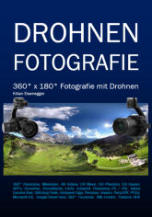
Welcome to my private homepage. 360° pictures or 3D pictures enjoy great popularity and have only become possible with digital photography. I create 360° pictures with high resolution and high precision from the ground as well as from the air. The images can be viewed with a web browser on a PC or mobile. I also create VR images which can be viewed with VR glasses. Since 2016, Facebook has also been display- ing 360° images interactively. You find a lot of tricks for 360° in my German book Drohnen Fototgrafie. You learn how to take sky zenith shots and how to stitch them with different methods. You learn how to integrated interactive 360° con- tent on a HTML 5 webpage. And there is a lot more 360° content in this book.iOS APP
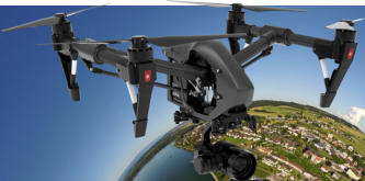
I programmed my own iOS APP‘s for the 360° drone photographers. Flatland images and photogrammetry missions are also supported by the APP. For the rescue of persons there is also a free APP for iOS.Photogrammetry
I have developed various 3D algorithms for the creation of photogrammetry objects. The drone flies around the object in a mathematical hemisphere and photographs the target object at a defined distance in meters.
hdrpano, Technische Fotografie, Hardware und Software Entwicklung, © Kilian Eisenegger 2026 info@hdrpano.ch, 4800 Zofingen, Switzerland, HTML 5 optimiert
Dynamic Views
I create 360° flight pictures, which put the viewer's perspective and perception in a new position. In addition, the visitor has the possibility to find his personal horizon from the viewed object. One feels as a visitor, as if one is personally at the place. The picture is interactive because the viewer directs his view to the object.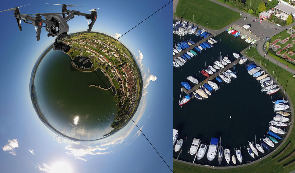
Google Street View and Google Maps
I am Google Street View certified. I can link panoramas with Google Maps. I use this technique myself when I travel, to get a virtual impression of the place before I go. Entries with 3D photos and a virtual tour are twice as likely to attract user interest. In 44% of all searches for a spe- cific company, mapping products are used. My 3D photos already have more than 23'000'000 views.
Social Media and 3D
I use HTML 5 technology to publish the 3D images. The images are compatible with Google Maps, iOS and Android mobiles, Facebook and many others. I use special methods to optimize the lens distortion and the edge drop when stitching.Drone rescue
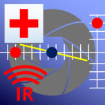
With the current thermal cameras XT2 Dual and Mavic 2 Enterprise Dual, it is even easier to search a terrain for people to rescue. I have developed a special APP for this purpose, which is available for free in the Apple Store.Mountains and Landscapes
I create high-resolution 3D images in places where otherwise only highly qualified mountaineers can be found. I also go out- doors in bad weather and use my own 3D panorama robots, which can cope with any weather.Architecture and Buildings
I can display buildings absolutely free of distortion. This is especially interesting for historical buildings where there are no plans.Videos on YouTube
I run my own video channel on YouTube. Here I reveal tricks and methods for drones and robot photography.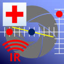
360° Views
Welcome to my private homepage. 360° pictures or 3D pic- tures enjoy great popularity and have only become possible with digital photography. I create 360° pictures with high resol- ution and high precision from the ground as well as from the air. The images can be viewed with a web browser on a PC or mobile. I also create VR images which can be viewed with VR glasses. Since 2016, Facebook has also been displaying 360° images interactively. You find a lot of tricks for 360° in my Ger- man book Drohnen Fototgrafie. You learn how to take sky zenith shots and how to stitch them with different methods. You learn how to integrated interactive 360° content on a HTML 5 webpage. And there is a lot more 360° content in this book.iOS APP
I programmed my own iOS APP‘s for the 360° drone photographers. Flatland images and photogrammetry missions are also supported by the APP. For the rescue of persons there is also a free APP for iOS.Photogrammetry
I have developed various 3D algorithms for the creation of photogrammetry objects. The drone flies around the object in a mathematical hemisphere and photographs the target object at a defined distance in meters.
hdrpano, © Kilian Eisenegger 2026, info@hdrpano.ch, 4800 Zofingen Switzerland
Dynamic Views
I create 360° flight pictures, which put the viewer's perspective and perception in a new position. In addition, the visitor has the possibility to find his personal horizon from the viewed object. One feels as a visitor, as if one is personally at the place. The picture is interactive because the viewer directs his view to the object.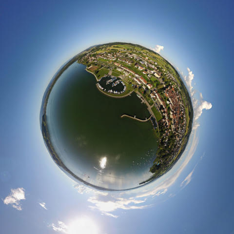
Google Street View and Google Maps
I am Google Street View certified. I can link panora- mas with Google Maps. I use this technique myself when I travel, to get a virtual impression of the place before I go. Entries with 3D photos and a virtual tour are twice as likely to attract user interest. In 44% of all searches for a specific company, mapping products are used. My 3D photos already have more than 23'000'000 views.
Social Media and 3D
I use HTML 5 technology to publish the 3D images. The images are compatible with Google Maps, iOS and Android mobiles, Facebook and many others. I use special methods to optimize the lens distortion and the edge drop when stitching.Drone rescue
With the current thermal cameras XT2 Dual and Mavic 2 Enterprise Dual, it is even easier to search a terrain for people to rescue. I have developed a special APP for this purpose, which is available for free in the Apple Store.Mountains and Landscapes
I create high-resolution 3D images in places where otherwise only highly qualified mountaineers can be found. I also go out- doors in bad weather and use my own 3D panorama robots, which can cope with any weather.Architecture and Buildings
I can display buildings absolutely free of distortion. This is especially interesting for historical buildings where there are no plans.Videos on YouTube
I run my own video channel on YouTube. Here I reveal tricks and methods for drones and robot photography.